


Muskingum & Perry Counties PUMA, Ohio
About
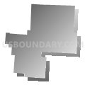
Outline

Summary
| Unique Area Identifier | 193736 |
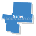
| Name | Muskingum & Perry Counties PUMA |
| State | Ohio |
| Area (square miles) | 1,085.07 |
| Land Area (square miles) | 1,072.55 |
| Water Area (square miles) | 12.52 |
| % of Land Area | 98.85 |
| % of Water Area | 1.15 |
| Latitude of the Internal Point | 39.87918310 |
| Longtitude of the Internal Point | -82.05525360 |
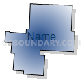
Maps


Graphs
Select a template below for downloading or customizing gragh for Muskingum & Perry Counties PUMA, Ohio


Neighbors
Neighoring Public Use Microdata Area (by Name) Neighboring Public Use Microdata Area on the Map
- Athens, Gallia & Meigs Counties PUMA, OH
- Fairfield County PUMA, OH
- Holmes, Guernsey & Coshocton Counties PUMA, OH
- Jackson, Hocking, Pike & Vinton Counties PUMA, OH
- Licking County PUMA, OH
- Washington, Morgan, Noble & Monroe Counties PUMA, OH
Top 10 Neighboring County (by Population) Neighboring County on the Map
- Licking County, OH (166,492)
- Fairfield County, OH (146,156)
- Muskingum County, OH (86,074)
- Athens County, OH (64,757)
- Guernsey County, OH (40,087)
- Coshocton County, OH (36,901)
- Perry County, OH (36,058)
- Hocking County, OH (29,380)
- Morgan County, OH (15,054)
- Noble County, OH (14,645)
Top 10 Neighboring County Subdivision (by Population) Neighboring County Subdivision on the Map
- Zanesville city, Muskingum County, OH (25,487)
- Falls township, Hocking County, OH (11,731)
- Union township, Licking County, OH (8,783)
- Falls township, Muskingum County, OH (8,131)
- Pike township, Perry County, OH (6,923)
- Walnut township, Fairfield County, OH (6,841)
- Springfield township, Muskingum County, OH (5,602)
- Newton township, Muskingum County, OH (5,373)
- Harrison township, Perry County, OH (5,253)
- Wayne township, Muskingum County, OH (4,731)
Top 10 Neighboring Place (by Population) Neighboring Place on the Map
- Zanesville city, OH (25,487)
- New Lexington village, OH (4,731)
- North Zanesville CDP, OH (2,816)
- Crooksville village, OH (2,534)
- New Concord village, OH (2,491)
- South Zanesville village, OH (1,989)
- Roseville village, OH (1,852)
- Pleasant Grove CDP, OH (1,742)
- Dresden village, OH (1,529)
- Harbor Hills CDP, OH (1,509)
Top 10 Neighboring Unified School District (by Population) Neighboring Unified School District on the Map
- Zanesville City School District, OH (26,957)
- Logan-Hocking Local School District, OH (24,026)
- Tri-Valley Local School District, OH (16,652)
- River View Local School District, OH (15,044)
- Morgan Local School District, OH (14,178)
- Lakewood Local School District, OH (14,097)
- Northern Local School District, OH (13,873)
- West Muskingum Local School District, OH (13,279)
- East Muskingum Local School District, OH (13,042)
- Franklin Local School District, OH (12,692)
Top 10 Neighboring State Legislative District Lower Chamber (by Population) Neighboring State Legislative District Lower Chamber on the Map
- State House District 5, OH (146,156)
- State House District 91, OH (130,644)
- State House District 92, OH (123,037)
- State House District 94, OH (117,946)
- State House District 93, OH (116,725)
Top 10 Neighboring State Legislative District Upper Chamber (by Population) Neighboring State Legislative District Upper Chamber on the Map
Top 10 Neighboring 111th Congressional District (by Population) Neighboring 111th Congressional District on the Map
- Congressional District 7, OH (683,371)
- Congressional District 18, OH (653,167)
- Congressional District 6, OH (623,742)
Top 10 Neighboring Census Tract (by Population) Neighboring Census Tract on the Map
- Census Tract 9658, Perry County, OH (7,221)
- Census Tract 7586, Licking County, OH (7,086)
- Census Tract 9659, Perry County, OH (6,975)
- Census Tract 9112, Muskingum County, OH (6,644)
- Census Tract 9663, Perry County, OH (6,150)
- Census Tract 311, Fairfield County, OH (6,088)
- Census Tract 9662, Perry County, OH (6,073)
- Census Tract 9128, Muskingum County, OH (6,066)
- Census Tract 9116, Muskingum County, OH (5,965)
- Census Tract 7589, Licking County, OH (5,959)
Top 10 Neighboring 5-Digit ZIP Code Tabulation Area (by Population) Neighboring 5-Digit ZIP Code Tabulation Area on the Map
- 43701, OH (55,643)
- 43725, OH (20,357)
- 43812, OH (19,061)
- 43138, OH (18,437)
- 43056, OH (17,439)
- 43724, OH (9,201)
- 43076, OH (9,051)
- 43764, OH (8,566)
- 43830, OH (6,158)
- 43731, OH (5,461)